
Our Services
Serving Northeastern Illinois
Wastewater and Septic
Test results serve to characterize soil and site conditions so a system appropriate for the property can be properly designed and installed.
What Is It?
More Info
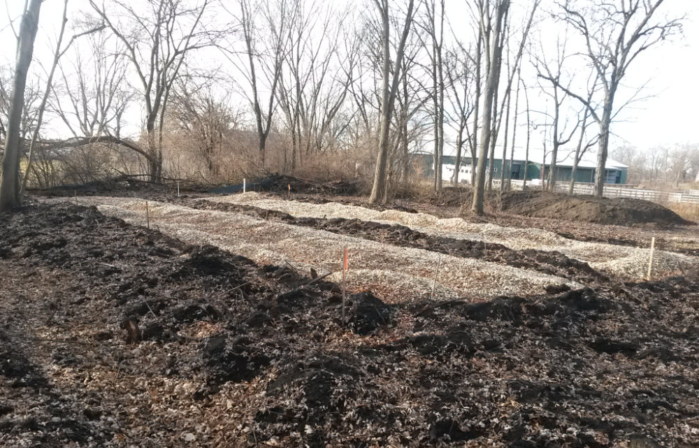
The purpose of testing is to identify an area (or areas) on a property suitable for a septic system. Test results serve to characterize soil and site conditions in order that a system appropriate for the property can be properly designed and installed. For vacant property, a building permit usually will not be issued without an approved septic system design. In most cases, testing will determine whether or not a property is “buildable”.
How Large An Area Will Be Tested?
More Info
This depends upon soil conditions, the volume of wastewater produced, and the type of system. Generally speaking, a conventional, trench-type septic system for a 3- to 4-bedroom residence on a property with “average” soil conditions will require an area about 3000 to 5000 square feet in size. An approved alternative system such as a mound type, buried sand filter, or drip irrigation typically can be constructed in smaller areas.
Requirements vary by county or municipality, but typically 3 to 4 samples are obtained and examined for each area proposed for the septic system. Additional sampling may be required if the soil conditions are extremely variable or if the system area is unusually large as a result of large wastewater volume or poor soil or site conditions.
How Are Samples Taken?
More Info
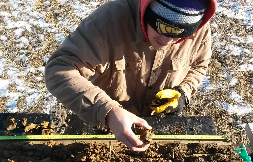
Testing is conducted using a truck-mounted hydraulic sampling rig. The rig pushes a tube into the ground to a depth of 5 to 7 feet, and extracts a core sample ranging from 1 to 3 inches in diameter.
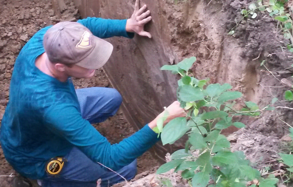
If the soil contains a substantial amount of rocks, is shallow to bedrock, has been disturbed by filling, or the site is inaccessible to the truck because of slope or dense woody vegetation, the soil may need to be examined from pits excavated by backhoe. In some cases, sampling can be conducted using hand tools.
Where Should The Testing Be Done?
More Info
For a conventional, trench-type system, the test area should be accessible by gravity from the home site. The specific distances separating the system from property and home site features may vary among each county or municipality. We have the expertise to assist our clients in selecting a test area or areas.
As a general guideline, the system should be located:
- 5 to 10 feet from the property line
- 20 to 30 feet from the foundation (10 feet from an accessory structure)
- 75 feet from a well
- 10 to 25 feet from a water supply line
- 50 feet from a body of water
- 25 feet from an in-ground pool (10 feet from an above-ground pool)
- 5 to 10 feet from a driveway
After the area is tested, you might consider flagging or staking it to keep vehicle traffic from damaging the area. Keep in mind that the area should not be driven on by heavy vehicles after the system is installed.
What Is Needed to Order a Soil Test?
More Info
For a vacant property, provide a plat of survey (or legal description, lot dimensions, and street name if survey is not available). For an existing residence or non-residential building, provide the property address and the survey or survey information.
Reasonably accurate property dimensions are essential because the test report must include a map showing sample locations. Indicate the proposed test area (building envelope) on the survey or from a site plan. This site plan need not be an architectural rendering – a hand-drawn diagram that includes enough information to identify the proposed test area will suffice. A Property Index Number (PIN) is extremely useful, especially for filing, permitting, and data retrieval.
Interpreting Test Results
More Info
The test report is written using technical language in a format required by the county or municipal Health Department. The information in the report is easily interpreted by Health Department staff and by licensed septic system designers and installers. We will gladly discuss the test results with you to make sure you understand the potential and limitations of the property.
Building Sites
We can identify and characterize soil and site conditions that may present limitations for home sites or small commercial buildings.
What Is It?
More Info
The purpose of testing is to identify and characterize soil and site conditions that may present limitations for home sites or small commercial buildings. These limitations may include seasonal wetness and ponding or disturbance as a result of cutting and/or filling. Knowing the nature and scope of any limitation will aid the client in determining the costs of overcoming the limitation.
How Large An Area Will Be Tested?
More Info
The test area typically consists of the envelope of the proposed building or building addition.
Generally, a minimum of 2 samples are obtained and examined within the building envelope. One sample is taken at the higher elevation and one at the lower elevation. Sampling depth typically is 1 to 2 feet below the anticipated footing depth. Additional sampling may be required if the soil conditions are extremely variable or the building envelope exceeds 4000 to 5000 square feet.
How Are Samples Taken?
More Info
Testing is conducted using a truck-mounted hydraulic sampling rig. The rig pushes a tube into the ground to the required depth and extracts a core sample ranging from 1 to 3 inches in diameter. Sampling may also be conducted by augering if the soil materials are hard or contain rock fragments.
If the soil contains a substantial amount of rocks, is shallow to bedrock, has been disturbed by filling, or the site is inaccessible to the truck because of slope or dense woody vegetation, the soil may need to be examined from pits excavated by backhoe.
What Is Needed to Order a Soil Test?
More Info
For a vacant property, provide a plat of survey (or legal description, lot dimensions, and street name if survey is not available). For an existing residence or non-residential building, provide the property address and the survey or survey information.
Reasonably accurate property dimensions are essential because the test report must include a map showing sample locations. Indicate the proposed test area (building envelope) on the survey or from a site plan. This site plan need not be an architectural rendering – a hand-drawn diagram that includes enough information to identify the proposed test area will suffice. A Property Index Number (PIN) is extremely useful, especially for filing, permitting, and data retrieval.
What We'll Provide You
More Info
The test results we provide include identification and classification of soil type and characterization of the nature of the soil materials, e.g. mineral or organic, natural or disturbed (cut/fill), soil parent and geologic materials. The results will also provide estimates of soil permeability and depth to the seasonal high groundwater table based on soil properties identified in the field including soil texture, structure, color, and presence of soil redoximorphic features. We cannot make measurements of soil strength or provide footing or foundation recommendations.
Detailed Soil Mapping
A detailed soil map prepared utilizing onsite investigations will provide valuable information needed for proper planning of a development.
What Is It?
More Info
Soil conditions present on a site are very important and strongly influence how the site may be used. The map can be interpreted to indicate areas suited to a given use, e.g. onsite wastewater disposal and treatment (septic systems), home sites with basements, stormwater retention and detention, and open space. Indeed, a number of county and municipal planning and zoning departments have enacted ordinances requiring some level of onsite soil mapping that identifies areas within a proposed development suitable for septic systems. The maps may also be used to identify critical soil areas or conservancy districts as defined by local ordinance.
Reconnaissance-type Investigation
More Info
Provides information relative to the general suitability or potential of a property for development. This type of investigation yields an interpretive map delineating units containing soils having similar potential for development. It delineates mapping units containing soils that would be poorly suited to development. The map is drafted on a recent aerial photograph for ease of use. The extent of each delineation can be measured to determine how much (by area and percentage) of the entire property that is suitable for development. A brief report of investigations addresses the general potential of the site for development while noting areas with significant limitations for development.
This type of general information is useful for clients who are considering purchasing a property for development, but need to complete their due diligence. It is also useful for a property owner who may be contemplating selling the property for development and is interested in determining its fair value, or developing the site his or herself.
More Detailed Mapping
More Info
Identifies and delineates individual soil types. This level of mapping provides site-specific information necessary to configure individual lots that contain areas suitable for buildings and septic systems (if central sewers are not available). It will identify areas better suited to storm water management or other type of open space. This level of mapping is often required by local ordinance at an early stage of the platting process.
The methodology for creating a detailed map also is often prescribed by local ordinance. It typically requires randomized sampling on a grid pattern having a set observation interval (commonly 200 feet). A topographic map with a contour interval of 1 to 2 feet serves as a base map. A detailed report of investigations includes logs of each sample location and a discussion of the soil mapping units relative to their suitability or potential for specific uses.

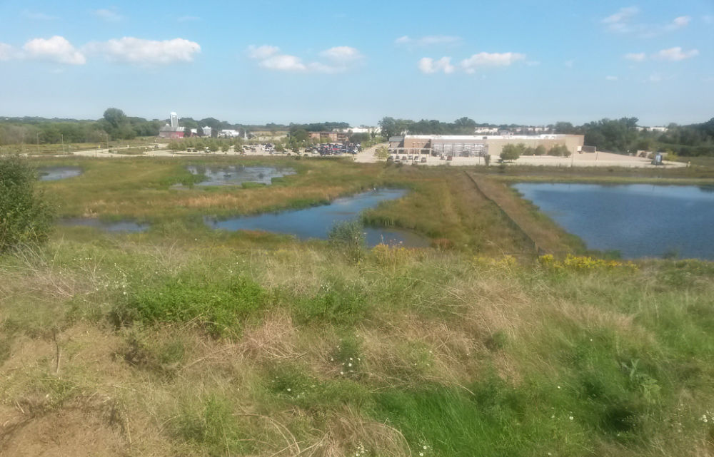
Stormwater Management
Estimating the depth to the seasonal high groundwater table and permeability of the soil allows for the proper design and installation of post-construction best management practices (BMPs).
What Is It?
More Info
As rural and suburban areas become more urbanized, impervious surfaces are created that may cause increased stormwater runoff and flooding. As a result, a number of counties and municipalities have adopted regulations to manage runoff and control flooding. These regulations apply to both new construction and improvements to existing buildings and infrastructure. Post-construction best management practices (BMPs) such as infiltration trenches, drywells, rain gardens, vegetated swales, and constructed wetlands serve to mitigate damage caused by flooding by controlling the volume of and improving the quality of stormwater runoff. Soil testing that characterizes soil wetness (the depth to the seasonal high groundwater table, soil permeability, and the Hydrologic Soil Group will provide the needed information for construction and installation of the post-construction BMP.
How Are Samples Taken?
More Info
Testing is conducted using a truck-mounted hydraulic sampling rig. The rig pushes a tube into the ground to a depth of 5 to 7 feet and extracts a core sample ranging from 1 to 3 inches in diameter.
If the soil contains a substantial amount of rocks, is shallow to bedrock, has been disturbed by filling, or the site is inaccessible to the truck because of slope or dense woody vegetation, the soil may need to be examined from pits excavated by backhoe. In some cases, sampling can be conducted using hand tools.
Where Should The Testing Be Done?
More Info
What Is Needed to Order a Soil Test?
More Info
What We'll Provide You
More Info
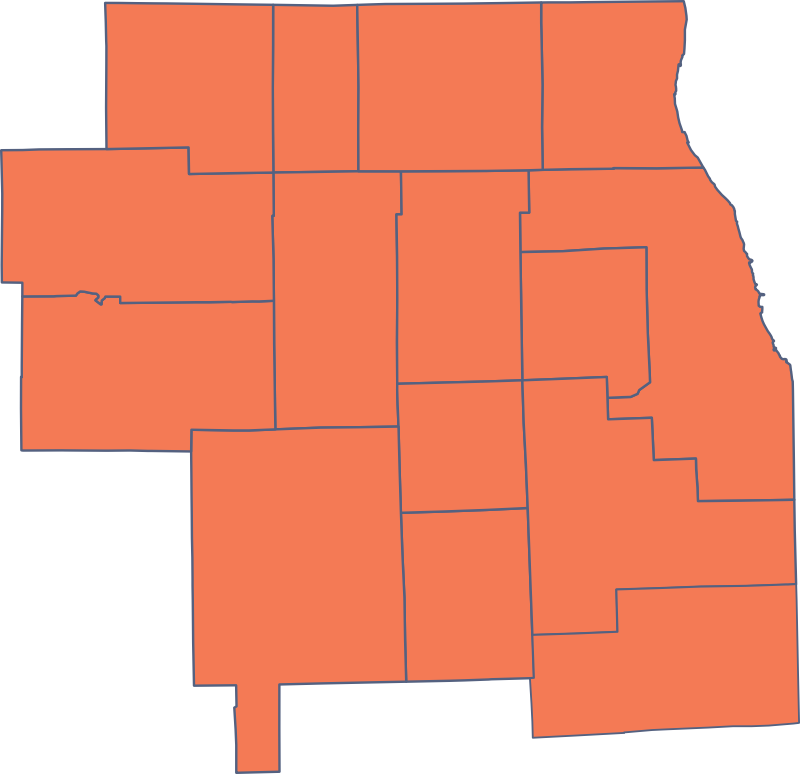
Our Service Area
We service Northeastern Illinois including the following counties:
- Boone
- Cook
- DeKalb
- DuPage
- Grundy
- Kane
- Kankakee
- Kendall
- Lake
- LaSalle
- Lee
- McHenry
- Ogle
- Will
- Winnebago
Experience You Can Trust.
Serving Your Local Area
Our Office
904 Powers Road
Woodstock, IL 60098-2702